- Definition of palm oil sustainability
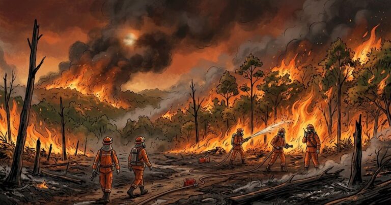
Indonesia’s palm oil industries are facing a dilemma regarding its role as driver of national economic growth and main supplier of global vegetable oils with resulted ecological impacts. Based on a number of researches, the expansion of oil palm plantations had caused deforestation, degradation of habitats, loss of biodiversity, greenhouse gas emissions, and fires in peat forests.
The increase of global demand of palm oil for foods and biofuel had resulted in the opening of new land areas, especially in Sumatra, Kalimantan, and Papua, making sustainability as the crucial aspect of palm oil production.
The sustainability of palm oil industries is defined through various principles of sustainability, which are reflected in the following certification:
- ISPO (Indonesian Sustainable Palm Oil)
- RSPO (Roundtable on Sustainable Palm Oil)
- ISCC (International Sustainability and Carbon Certification)
According to ISPO, the sustainability is based on the seven main principles, namely:
- Legal compliance
- Good plantation practices
- Management of environment, natural resources, and biodiversity
- Employment responsibility
- Social responsibility and empowerment of people’s economy
- Transparency
- Growing business sustainably
The RSPO outlines the sustainability principles in eight principles, which are essentially in line with those of ISPO. The principles and criteria of both ISPO and RSPO have over 100 indicators audited by independent survey firms.
The community participation, particularly among smallholders who control over 40% of Indonesia’s oil palm plantations, is the key to successfully increasing national productivity. However, they are still hindered by limited access to information, funding, and technical assistances.
Global market support, economic incentives, and capacity building for smallholders provide opportunities to demonstrate the sustainability of oil palm plantations through ISPO, RSPO, and ISCC certification.
- Geospatial Technology to Determine Location Information
Location information is important because it can function as evidence to show that palm fresh fruit bunches (FFB) did not originate from forested land after 31 December 2020, as required by the European Union Deforestation-Free Regulation (EUDR).
The form of location information:
- Coordinate point
- Collection of coordinate points in the form of a line
- Combination of polylines
- Polygon
With location information, EUDR authorities in Europe can verify whether plantation locations comply with EUDR requirements using historical forest maps such as those from Global Forest Watch (GFW).
This location information can be combined with supply chain traceability (from farmer to mill to refinery to ship) for subsequent third-party audits. Complying with due diligence by attaching location information will increase the acceptability of Indonesian palm oil products in the European Union.
How is it obtained?
Location information is obtained by using geospatial technologies, which include:
- Terrestrial – mapping instruments, including GPS
- Aircraft-based – unmanned and manned drones
- Satellite-based – satellite remote sensing
These three technologies are capable of producing geospatial maps with varying levels of accuracy.
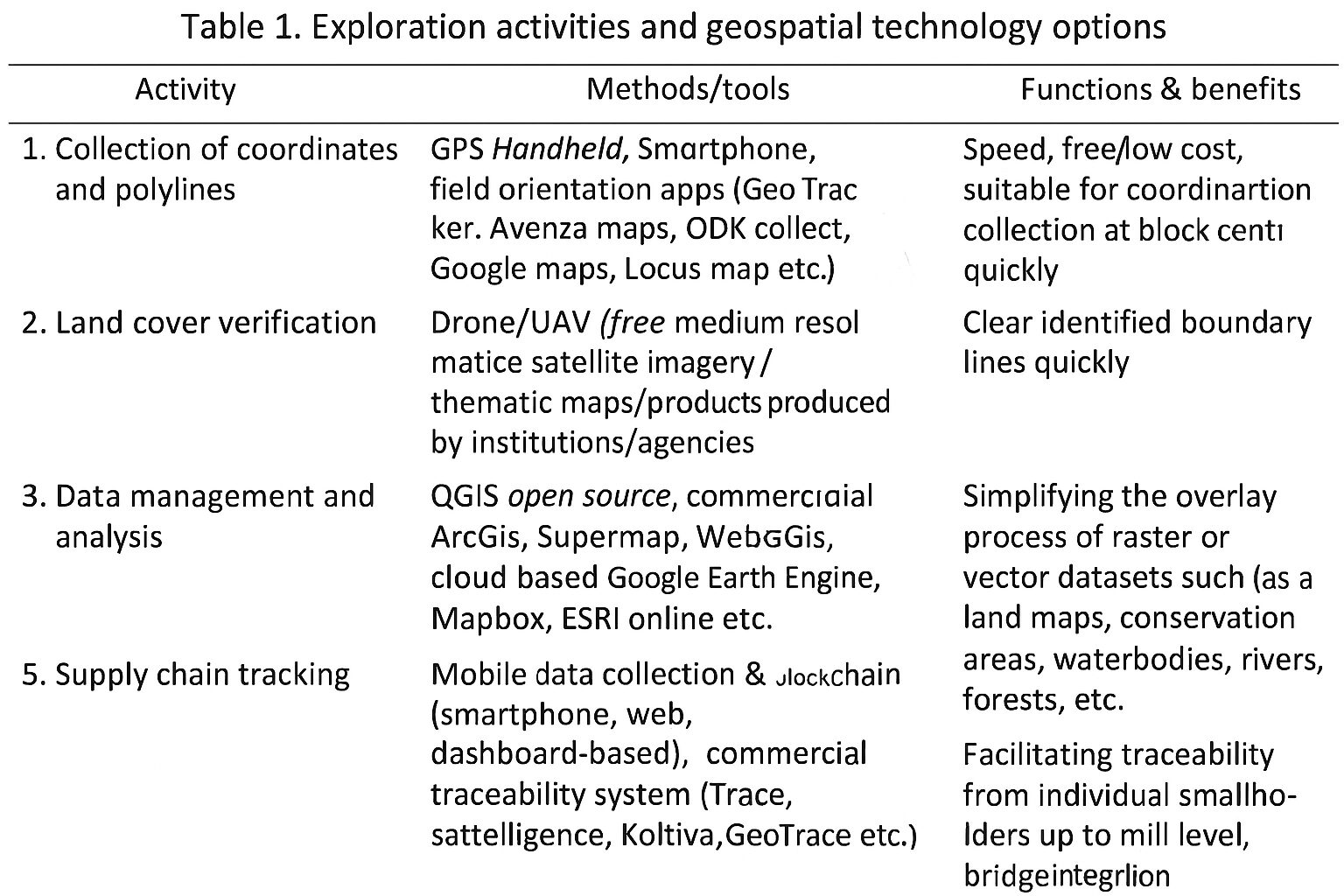
Table 1 (example of content): Activities of tracking deforestation and options of geospatial technology that can be used to acquire coordinate points, polylines, or polygons.
- Fulfillment of Location Information Traceability
3.1. How to Analyze Deforestation cases
In the context of deforestation monitoring and analysis, the commonly used method is forest cover analysis from multi-temporal remote sensing satellite imagery. More detailed analysis can include:
- Tree counting → counting the number of oil palm trees
- Boundary delineation → determining land boundaries
- Vegetation index monitoring → monitoring plant growth
- Analysis of other data for land use change
Developments in geospatial technology and the support of artificial intelligence (AI) have made analysis results increasingly accurate, and can even be used for crop yield predictions. The latest technology of satellite-based remote sensing can provide very high spatial resolution, for example:
- Worldview 3 & 4 → 31 cm panchromatic
- Pleiades Neo → 30 cm panchromatic
- Pleiades Neo Next → resolution up to 20 cm
Cloud problems in tropical regions like Indonesia can be tackled by combining satellite radar data, for example:
- Sentinel (ESA)
- TerraSAR-X (Germany)
- ALOS (Japan)
- Radarsat (Canada)
The combination of optical and radar satellites can produce cloud-free imagery for tropical regions. In addition, the use of multispectral and hyperspectral imagery enables the development of advanced algorithms for deforestation analysis.
The Geospatial Information Agency (BIG) plays a crucial role through its Continuously Operating Reference Stations (CORS) program, a network of continuously operating GPS reference stations that provide high-accuracy, real-time GPS correction data. This system supports multi-temporal satellite imagery analysis.
Currently, the maps used as the EUDR baseline for tracking deforestation are as follows:
- Global Forest Cover (GFC) 2020
- Global Forest Cover Changes (GFCC) with 10 m resolution (produced by the European Union Forest Observatory)
This map product includes:
- Land cover (ESA World Cover) → basic layer for determining cover area
- Tree height data → forest area identification
- Land use data → distinguishing between forests and plantations
- Crop data → plantation area identification
Reference: European Union Forest Observatory
3.2. Inconsistency of coordinate accuracy and deforestation map
A number of geospatial technologies can be considered to fulfill the EUDR requirements for seven commodities traded on the European market (see Table 1).
According to EUDR Article 2, Paragraph 28:
- Geolocation (location information) is the geographical position of a land parcel expressed using latitude and longitude coordinates.
- At least one latitude and one longitude point with a precision of six decimal places.
- For land parcels larger than 4 hectares, the geolocation must be provided in the form of a polygon with a sufficient number of coordinate points to describe the outer boundaries.
Coordinate accuracy calculation:
- 1 degree ≈ 111 km (111,000 m)
- Precision of 6 decimal places = 0.000001 × 111 km = 11.1 cm
This means that deforestation maps must show land changes with a resolution of 11.1 cm. However, the data currently used (GFC & GFCC) only has a resolution of 10 m.
Contradictions:
- The GFCC map (10 m) is not comparable to the 11.1 cm accuracy at 6 decimal places.
- It should use 4 decimal places, which is equivalent to 10 m resolution, to make it consistent with the current map baseline of deforestation.
Relevant ultra-high-resolution data sources:
- Worldview-3 → 30 cm resolution, can be processed to 15 cm using super-resolution methods
- Drones → flying at an altitude of 250–300 m with a special camera → 10 cm resolution
Field facts:
- Tree canopy diameter of lowland tropical forest: 15–25 m
- Tree canopy diameter of tropical peat forest: 10–20 m
- Tree canopy diameter of tropical mountain forest: 8–15 m
Therefore, clearing land for oil palm plantations will result in a minimum forest loss of equivalent to 8–25 m, far greater than the 11.1 cm accuracy required by the EUDR.
- Illustration of Deforestation Tracking Based on Crop Field
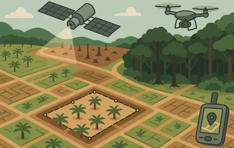
Figure 1 (illustration) shows the determination of location information (coordinates) based on the spread of smallholders’ oil palm plantations around the forest (assuming their plantation area of approximately 4 hectares).
- Smallholders’ oil palm plantations A and B are located in a deforested area.
→ Coordinates can be taken from the midpoint of plantation A or B, or from corner points 2, 3, 4, 5, 6, and 7 of plantation B.
- For plantations of C, D, E, F, G, H, and I, the deforestation analysis only uses coordinates 8–24. A full polygon (red shapefile) covering all plantations is not necessary.
- Alternatively, use the midpoint of each plantation (C–I).
- The same applies to plantations of non-smallholders (>4 hectares).

- Sharing Data Regulation and Inter-Institutional Synergy
The Directorate General of Plantations at the Ministry of Agriculture had once issued a letter prohibiting the sharing of plantation data with foreign institutions, citing prevailing regulations issued by related government agencies. This letter then serves as a guideline for plantation companies in Indonesia, including oil palm plantations.
In line with the regulations, the Minister of Agrarian Affairs and Spatial Planning in 2016 also sent a letter to the Indonesian Palm Oil Association (GAPKI), as well as to companies obtaining RSPO certification in 2020, urging them not to share plantation concession polygon data in SHP format.
Several Indonesian palm oil companies are currently preparing documents to comply with EUDR requirements. In the context of palm oil, geolocation and traceability information from plantations to palm oil mills (PKS) and refineries has been completed for company-owned nucleus plantations which plan to enter the European market. However, problems related to geolocation data and legality remain prevalent in most of smallholders’ plantations.
One of the challenges in incorporating Fresh Fruit Bunches (FFB) from smallholders’ plantations into the European export supply chain is the lack of documentation on the location and legality of the plantations due to various issues. Because the EUDR requires the uploading of these documents to a European Union server, government’s involvement is necessary to assist in the preparation of documentation on the location and legality of smallholders’ oil palm plantations.
A government program that provides information on plantation location and legality is the Cultivation Registration Certificate (STDB), which is issued by the Ministry of Agriculture and local governments at the district/city levels. Currently, the Ministry of Agriculture’s e-STDB has successfully registered 225,000 smallholders’ oil palm plantations, covering a total area of 630,000 hectares, which are registered or in the process of being registered. But it only represents less than 10% of the total number of oil palm smallholders, and of the 6.5 million hectares of oil palm plantations owned and managed by the smallholders.
With the letter from the European Commission on Environment, Water Resilience and a Competitive Circular Economy dated September 23, 2025, regarding the planned second postponement of EUDR implementation until the end of 2026, the government, the palm oil industries, and smallholders have additional time to accelerate the ISPO certification, including the geolocation of smallholders’ plantations and the traceability of fruit production and processing until resulting into export products to Europe. It is hoped that cooperation between plantation companies, smallholders, local communities, and cross-ministerial government agencies will realize the ISPO certification in half of the oil palm plantations, especially those around palm oil mills whose product are purchased by European industries and consumers.
One solution for sharing much-needed geospatial data for smallholders is the National Sustainable Commodity Dashboard, which has been launched since the past two years. As a government application managed by a ministry, the National Dashboard can provide plantation location and legality information to those who need it. This platform serves as the Indonesian government’s guarantee of the sustainability of national oil palm plantations, which is expected to be trusted and accepted by European trade authorities, as it can be accessed and audited at any time.
Hopefully, one of the following possibilities will be realized within the next year:
- The government, through related institutions, will create regulations and technical guidelines that will enable commodity exporters to share geospatial information and legality data with buyers and trade authorities in Europe, or
- The National Dashboard is accepted as a replacement for European operators’ obligation to upload geospatial data to the EUDR server because:
- It is believed to be equivalent to RSPO and ISCC certification, including in terms of audit quality and data accuracy, or
- It provides geospatial access and traceability of export commodities, which demonstrate that plantations do not cause deforestation.
The additional time of 15 months is a short time to fix regulations and technical guidelines that will allow the Indonesian agricultural commodities to continue reigning in the global market for decades to come. Looking backward to the experience of the past 26 months, time past so quickly that the challenges of three years ago are still the subject of presentations and discussions today.
Accelerating ISPO (Indonesian Sustainable Palm Oil) certification and harmonizing regulations across more than 30 ministries and institutions related to palm oil are two cross-ministerial/institutional work priorities needed to maintain Indonesia’s leading position in the global trade of palm oil products. That way, hopefully, the history of cloves, nutmeg, cinnamon bark, other spices, coffee, and rubber, which plummeted from superior rankings to the inferior rankings in just a few decades, will not be repeated. (*)
Agus Purnomo and Ketut Wikantika. Agus Purnomo. Director, Sinarmas Agribusiness & Food; Senior Advisor on Sustainability GAR. Ketut Wikantika, Head of Plantation Monitoring and Planning, Sinarmas Agribusiness & Food; Researcher at the Center for Remote Sensing, Bandung Institute of Technology (ITB).